
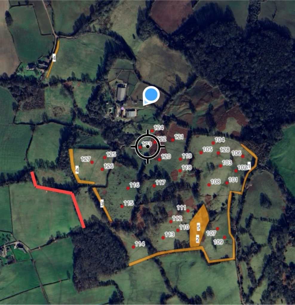
Accurate mapping is the foundation of every successful forestry, agricultural and land management project. At White Hart Forestry Ltd, we combine industry-leading GIS technology with practical field experience to produce clear, accurate mapping that supports informed decision-making, regulatory compliance and efficient project delivery.
Whether you require detailed woodland mapping, grant application plans, estate surveys or operational maps, our team delivers professional outputs tailored to your specific requirements. Every map is produced using high-accuracy spatial data and can be supplied in a range of digital formats suitable for RPW, NRW, Forestry England and other regulatory bodies.
Our mapping services are designed to save time, reduce uncertainty and provide a clear understanding of the opportunities and constraints across your property.
Our GIS & Surveying Services
- Woodland compartment mapping
- Woodland creation design plans
- Grant application mapping
- Estate and farm mapping
- Boundary verification and digitisation
- GPS field surveys
- Tree and woodland inventories
- Habitat and environmental mapping
- Ancient woodland and PAWS mapping
- Constraints and opportunities assessments
- Public rights of way and access mapping
- Watercourse and riparian buffer mapping
- Fencing and infrastructure plans
- Timber harvesting and extraction plans
- Restocking and planting maps
- Carbon and natural capital mapping
- Drone survey integration
- Area calculations and land measurement
- Shape file (.SHP), GeoPackage and CAD data production
- High-quality presentation maps for reports and planning applications
Accurate Data You Can Trust
Our consultants utilise the latest GIS software alongside field-verified survey data to ensure every project is built upon reliable information. By combining satellite imagery, aerial photography, GPS survey data and environmental datasets, we produce maps that are both technically robust and easy to interpret.
From a single woodland compartment to large estate portfolios, we provide mapping solutions that support woodland management, timber harvesting, habitat enhancement, woodland creation, natural capital projects and long-term estate planning.
Whether you are applying for woodland grants, preparing a management plan, planning new planting or managing existing woodland, our GIS mapping services provide the clarity needed to make confident decisions.